Stories from Prenter
Meet the Lamberts and the Seboks
In the 10 mile stretch of Prenter Rd., there are roughly 300 households sitting in the nooks and crannies of the valley, with about 700 people residing in the dwellings. Most of these households are supported by the coal industry in some fashion or other, miners, coal truck drivers, heavy equipment operators, prep plant workers, and contractors just to name some of the occupations. Prenter was founded on coal, deep in one of the most mined counties in the country.
Based on the local graveyards, it is estimated that people settled in the area about 110 years ago. It is believed that Prenter grew into a fully fledged “camp” in large part due to the Red Parrot Coal Company, which opened a new tipple in 1938 creating 500 new jobs in the area. Up until the late 1950's Prenter area mining was exclusively underground. In the late 1950’s an auger mine, recognized as the beginning of strip mining, opened up, changing mining trends in the area. By the summer of 2001, Pine Ridge Coal, who had acquired the rights to mining operations around Prenter, was producing 9,000 tons of coal a day.
The communities in Prenter are very close knit and share a long history. The people are proud of their families, land, and occupations. There are numerous stories to be shared and we hope to have more soon. Here is an example of a Prenter Rd. family -- the Lamberts.
The family photographs and the two recorded interviews (Maria Lambert and Patty Sebok) that appeared on this page were lost before 2010.
Rachel Chapman Lambert, b. April 18, 1918, and Clinton B. Lambert, b. May 1912, were the parents of 4 children, one of whom is Ralph Lambert, Maria’s husband.
Maria Lambert is a lifelong resident of the Laurel Creek Watershed and has lived in her home in Sandlick for the past 8 years surrounded by her family members and loved ones. The water quality issues affecting her family and community have led her to speak out for clean water for her community. Listen to an interview with Maria, and then learn about her family through the pictures that she shared with us.
Aulden Stewart (left) was Maria’s great grandfather. He moved to Logan County, West Virginia from Webbville, KY to work in the mines during the winter. He would travel back to Kentucky to work on his father’s farm during planting and harvesting time. Auldren was killed in the mines Feb 3, 1918 at Accoville in Logan county.
(Left) Robert L. Bradley & Martha J. Ester Bradley. (Right) Hensford Lee & Laura Bradley.
Robert L and Martha Jane Estep Bradley were Maria’s great grandparents, and the parents of Hansford, pictured on the right with his wife. Robert was a circuit preacher and Sunday school teacher. Martha Jane died from natural causes in January of 1959, and her husband followed her a few weeks later. In the picture on the right are Maria’s grandparents, Hansford Lee and Laura Pearl Jarrell Bradley. Hansford worked on the railroad and in the mines all of his life, and Laura was a community service worker. They had seven children, one of which was Maria’s mother, Melba.
Pictured here is Melba, Maria’s mother, at 4 years old, pictured on the Gordon side of Williams mountain. They later moved to the top of Williams mountain, to the south of where Maria currently lives.
Pictured here are Harry Gay and Mildred Caldwell Stewart, Maria’s grandparents on her father’s side, on their 50th wedding anniversary.
This picture shows five generations of the Stewart family: Jerry Stewart, Harry Gay, Maria, her daughter stacy, and her great grandmother Barbara Ann Carey.
Patty Sebok has lived in Prenter Hollow for 31 years with her husband Butch. In this interview, she talks about how she first found out about their contaminated well water, health concerns in her community, and the emergency water project for the communities of Prenter Road.
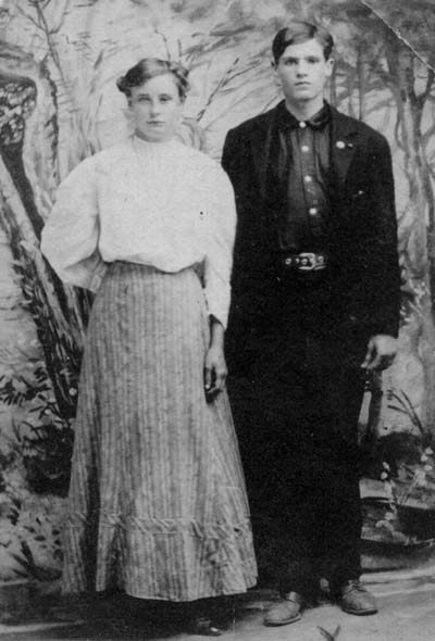
Above are the parents of Patty's mother, James Thomas Cartwright (born in Lawrence County) and Elender Stamper (born Carter Co., KY) They were married at Grayson, Carter County, KY on November 18, 1907. The husband's job was listed as coal miner, but Patty says there is no place to write down the occupation for the wife! "Mom told me they came to WV from KY because they heard you could make a better living here. Ain't that a hoot?" Patty says.
They settled on Cabin Creek, WV, where Patty's mom was born in 1917. She lost her dad when she was 3 years old, when he went on the Blair Mountain march and never returned. They told Patty's mom that he jumped off a train in the Big Sandy river and committed suicide, but the family has doubts. He was buried before she go
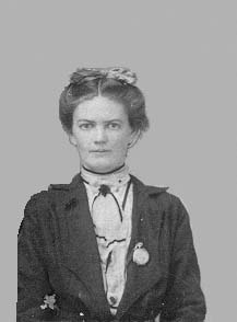
Above is Minnie Hale Scott Massery, the mother of Patty's father. She lived on White Oak Mtn, which they called it Scott Mtn because they bought the land at a court action and had almost 3,000 acres. Here is a story from Patty's family about the land (from Those Incredible Scotts):
Richard, Minnie's grandfather, made a land purchase located on Clear Creek, North of Coal River, which was further described as the “Rock House Survey”. There were 186 acres involved in that purchase.That land purchase would become known as The Rock House, and a home for many of the Scott clan. Some time later Richard entered into an additional land purchase, forming a partnership with a man by the name of John F. Clay. They jointly negotiated a purchase of 2989 acres being sold on the Fayette County courthouse lawn for default in tax payments. The nearly 1,500 acres falling to Richard would bring into existence what is known until today as Scott Mountain, located at the headwaters of Little White Oak Creek. The water shed would direct water courses down Little White Oak Creek on the Boone County side to empty into Coal River, and into the Great Kanawha. However, the county line ran along the ridge of Scott Mountain, passing through the Scott properties. This meant that part of the property was situated in Kanawha County, and water shed from this part of the property flowed down Dawes Creek to empty into Cabin Creek, and into the Great Kanawha some 30 miles upstream from the junction of Coal and Kanawha Rivers.The county line ran by the school house “out on the ridge”, and the kids of later years would many times have their pictures taken with one foot in Kanawha County, and the other in Boone County. It would become a favorite pose that would make history. The schoolhouse and community out on the ridge grew a strange mixture of Scott’s, Asbury’s, Carr’s, Cooper’s, Pettrey’s, Massey’s, Foster’s, Browning’s, Presley’s, Pruitt’s, and Greene’s.The area has been stripped now, and Patty says she has not been to the family cemetary since she was 8 years old.Patty's mother and sister (more information coming)
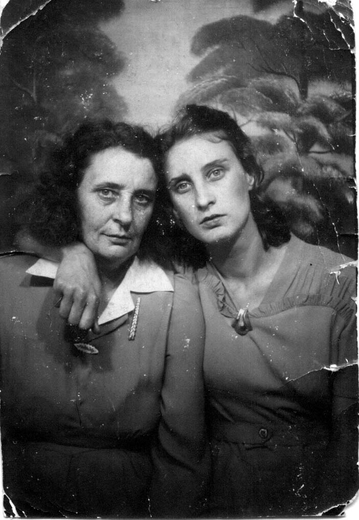
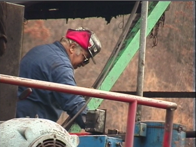
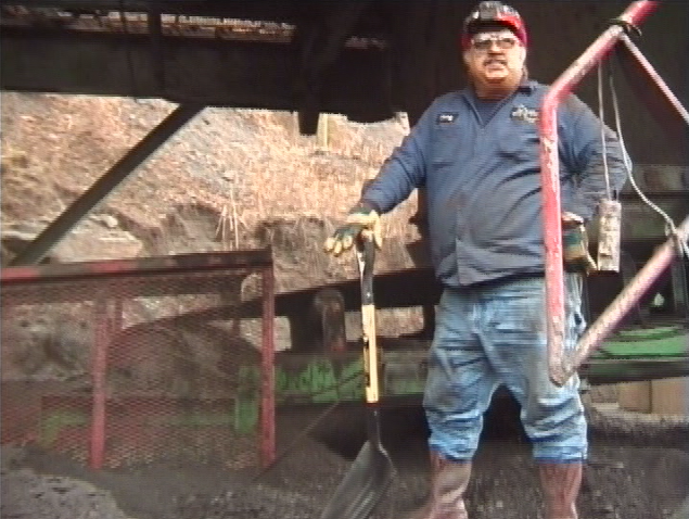
Photos courtesy of Catherine Pancake
Here is Patty's husband, Butch. More information coming here soon!
Sylvia_Bradford1-max.mp3Sylvia Bradford clip 1hazy-04-hazy-and-shumates-today
Sylvia_Bradford2-max.mp3Sylvia and Rick Bradford on how MTR has affected their liveshazy-04-hazy-and-shumates-today
Sylvia_Bradford3-max.mp3The Bradfords and trainshazy-04-hazy-and-shumates-today
debbie_jarrell-1-max.mp3Debbie Jarrell on disappearing housing stockhazy-04-hazy-and-shumates-today
Charles-EdClip3.mp3Ed Wiley on the Appalachian Mtns. and waterhazy-04-hazy-and-shumates-today
Sylvia_Bradford5-max.mp3The Bradfords on lack of accesshazy-04-hazy-and-shumates-today
debbie_jarrell-1-max.mp3Debbie Jarrell on Marsh Fork Elementarycoal_river_101-06-changes-in-lifestyle
debbie_jarrell-2-max.mp3Debbie Jarrell on lack of access to the mountainscoal_river_101-06-changes-in-lifestyle
MTR2CharlieBEdit1.mp3Charles Ballard on changes since MTRcoal_river_101-06-changes-in-lifestyle
BettyRoss.mp3Betty Ross on Floodingcoal_river_101-06-changes-in-lifestyle
Meadows1.mp3Jimmy Meadows on outmigrationcoal_river_101-05-outmigration
judy_crm_clip1.mp3Judy Bonds on Coal River Mountaincrm-01-current-land-use-on-coal-river-mountain
Charles-EdClip2.mp3Ed Wiley on Health Effects at MFEhazy-02-marsh-fork-elementary
Thompsonclip1.mp3Ernie Thompson on Slurry Impoundmentsmtr-02-environmental-impacts
Thompsonclip2.mp3Ernie Thompson "Money got in the way"mtr-03-legislation-permits-regulations
Maria1.mp3Maria Lambert on Water Qualityprenter-04-health
Rory-GB4.mp3Gary Anderson on Coal River Windwind-01-introduction-to-coal-river-wind
Rory-GB3.mp3Barbara Anderson discusses Mountain Access and Traditional Usewind-01-introduction-to-coal-river-wind
Rory-Chuck1.mp3Chuch Nelson on Threat of Valley Fills on Coal River Mountainwind-02-the-threat-of-mtr-on-coal-river-mountain
Rory-GB2.mp3Gary Anderson describes 2001 Clear Fork Floodswind-02-the-threat-of-mtr-on-coal-river-mountain
Rory-Chuck4.mp3Chuch Nelson "We gotta shut 'em down"wind-02-the-threat-of-mtr-on-coal-river-mountain
Rory-Judy2.mp3Judy Bonds "The Last Vestige of Jobs and Sustainability"wind-03-the-coal-river-mountain-wind-campaign
Rory-GB5.mp3Gary Anderson Imagines a New Wind Industrywind-04-wind-vs-mtr-for-coal-river-mountain-the
Rory-Chuck3.mp3Chuck Nelson "This is Our Last Chance"wind-06-a-just-transition
MTR2VernonHEdit1B.mp3Vernon Haltom on Protecting Places and Resourcescrm-01-current-land-use-on-coal-river-mountain
EdWileyInEdit1.mp3Ed Wiley "A Magical Place"crm-02-community-land-use-in-coal-river-valley
Meadows1.mp3Jimmy Meadows on Loss of Underground Mining Jobscrm-03-undergound-mining
Charles-EdClip1.mp3Ed Wiley on Sludge Impoundmentshazy-02-marsh-fork-elementary
238002.mp3Laffon Pettry, "Molly mooching"crm-02-community-land-use-in-coal-river-valley
080009.mp3Donna Wills, "nothing I can't can"crm-02-community-land-use-in-coal-river-valley
074025.mp3Randy Halstead, Joys of ginsengincrm-02-community-land-use-in-coal-river-valley
077007.mp3Joe Aliff, harvest timecrm-02-community-land-use-in-coal-river-valley
088006.mp3John Bowman, keeping the mash warmcrm-02-community-land-use-in-coal-river-valley
050002.mp3Benny Turner, Native Americans on Bolt Mtn.coal_river_101-01-history-of-coal-river-part-1
077010.mp3Joe Aliff and his Cherokee grandfathercoal_river_101-01-history-of-coal-river-part-1
119011.mp3Howard Miller, corn-woodland-pastureland systemcoal_river_101-01-history-of-coal-river-part-1
215001.mp3Howard Miller, people hiding on mtn. from marauding soldierscoal_river_101-01-history-of-coal-river-part-1
Joe_Aliff_we_had_a_full_fledged_war_077022.mp3Joe Aliff, arming miners for Battle of Blair Mtn.coal_river_101-02-history-of-coal-river-part-2
046012.mp3Mae Bongalis, a visit with Mother Jonescoal_river_101-02-history-of-coal-river-part-2
141006.mp3Cody Dickens, a visit from the land companycoal_river_101-04-absentee-land-ownership
162008.mp3Dr. Jim Michael Wills of Rock Creek on absentee landownershipcoal_river_101-04-absentee-land-ownership
038002.mp3Shorty Bongalis on West Virginians migrating to Ohiocoal_river_101-05-outmigration
088003.mp3John Flynn about moonshinincoal_river_101-05-outmigration
088004.mp3John Bowman, staying in Coal River by moonshinincoal_river_101-05-outmigration
077024.mp3Joe Aliff, how Coal River Mtn. is a drug storecrm-01-current-land-use-on-coal-river-mountain
Thompsonclip1.mp3Ernie Thompson, former mine inspector on slurry impoundmentscrm-05-the-brushy-fork-slurry-impoundment
Jen-JackSpaderoClips.mp3Jack Spadero, engineer on impacts of MTR and slurrycrm-05-the-brushy-fork-slurry-impoundment
Rory-GB4.mp3Gary Anderson, Coal River Mountain Wind campaignwind-06-a-just-transition
Rory-Judy1.mp3Judy Bonds, coal is NOT West Virginiawind-06-a-just-transition
hazy-01-near-the-mouth-of-hazy1hazy3
coal_river_101-01-history-of-coal-river-part-11coal-river-1011
crm-01-current-land-use-on-coal-river-mountain1crm2
prenter-01-prenter-and-surrounding-communities1prenter4
mtr-01-introduction1mtr6
wind-01-introduction-to-coal-river-wind1wind7
cresources-01-community-resource-mapping1cresources5
hazy-02-marsh-fork-elementary2hazy3
coal_river_101-02-history-of-coal-river-part-22coal-river-1011
crm-02-community-land-use-in-coal-river-valley2crm2
prenter-02-water-quality2prenter4
mtr-02-environmental-impacts2mtr6
wind-02-the-threat-of-mtr-on-coal-river-mountain2wind7
cresources-02-children-are-the-future-of-the-coal-rive2cresources5
hazy-03-absentee-land-ownership3hazy3
coal_river_101-03-glimpse-into-a-coal-river-family-mid-20t3coal-river-1011
crm-03-undergound-mining3crm2
prenter-03-coal-slurry3prenter4
mtr-03-legislation-permits-regulations3mtr6
wind-03-the-coal-river-mountain-wind-campaign3wind7
cresources-03-bill-lucas3cresources5
hazy-04-hazy-and-shumates-today4hazy3
coal_river_101-04-absentee-land-ownership4coal-river-1011
crm-04-forest-resources-and-timbering4crm2
prenter-04-health4prenter4
wind-04-wind-vs-mtr-for-coal-river-mountain-the4wind7
cresources-04-chronicling-the-coal-river-valley-s-coal4cresources5
hazy-05-update-lawsuits-possible-new-location-fo5hazy3
coal_river_101-05-outmigration5coal-river-1011
crm-05-the-brushy-fork-slurry-impoundment5crm2
prenter-05-community-responses5prenter4
wind-05-wind-vs-mtr-for-coal-river-mountain-ener5wind7
cresources-05-clear-fork-couple5cresources5
coal_river_101-06-changes-in-lifestyle6coal-river-1011
crm-06-community-letter-to-w-va-gov-joe-manchin6crm2
prenter-06-stories-from-prenter6prenter4
wind-06-a-just-transition6wind7
cresources-06-connie-and-terry-dillon6cresources5
prenter-07-news7prenter4
wind-07-update-blasting-has-begun-on-coal-river7wind7
cresources-07-danny-cook-and-mack-james-creek7cresources5
wind-08-organizing-for-wind-power8wind7
cresources-08-debbie-jarrell8cresources5
cresources-09-delbert-and-judy-gunnoe9cresources5
cresources-10-elmer-mays-horse-creek10cresources5
cresources-11-frankie-mooney11cresources5
cresources-12-gary-and-barb-anderson12cresources5
cresources-13-jimmy-platt13cresources5
cresources-14-junior-walk14cresources5
cresources-15-justin-wills15cresources5
cresources-16-kathleen-dickens16cresources5
cresources-17-kay-and-danny-howell17cresources5
cresources-18-kendra-dickens18cresources5
cresources-19-lonnie-burnside19cresources5
cresources-20-project-build-it-up-wv-summer-youth-prog20cresources5
cresources-21-project-community-greenhouse21cresources5
cresources-22-project-first-solar-thermal-installation22cresources5
cresources-23-project-greenhouse-gardens23cresources5
cresources-24-project-mural-project-in-whitesville24cresources5
cresources-25-project-the-tadpole-project25cresources5
cresources-26-rachel-bey26cresources5
cresources-27-ray-and-lottie-cottrell27cresources5
cresources-28-sandy-simmons28cresources5
cresources-29-shannon-dickens29cresources5
cresources-30-sharon-thompson30cresources5
cresources-31-sheila-and-natasha-walk31cresources5
cresources-32-sherry-geisler32cresources5
cresources-33-wilma-cook33cresources5
Charles Ballardcoal_river_101-06-changes-in-lifestyle
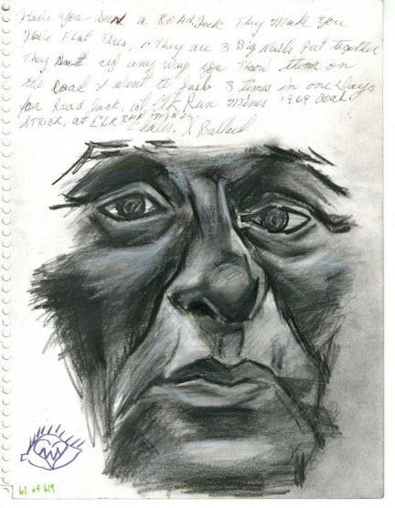
Judy Bondscrm-01-current-land-use-on-coal-river-mountain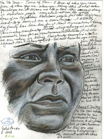
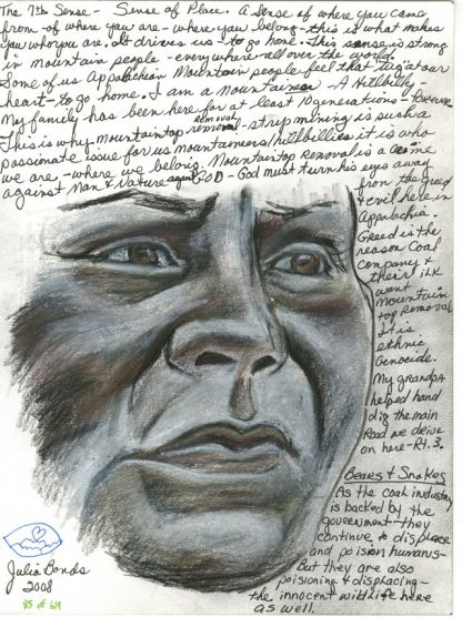
Judy Bonds, 1 of 3coal_river_101-01-history-of-coal-river-part-1
Judy Bonds, 2 of 3coal_river_101-01-history-of-coal-river-part-1
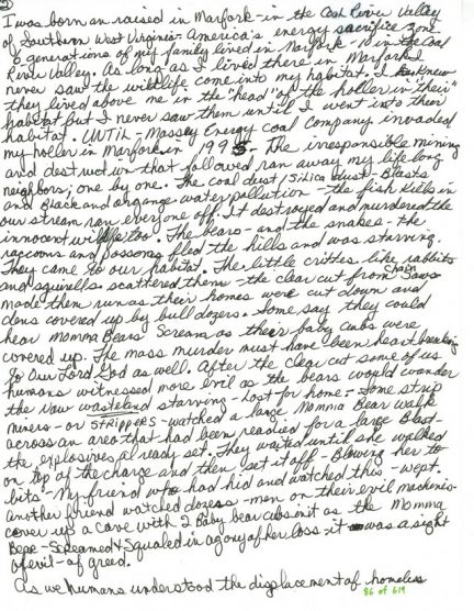
Judy Bonds, 3 of 3coal_river_101-01-history-of-coal-river-part-1
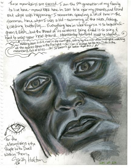
Sarah Haltomcrm-01-current-land-use-on-coal-river-mountain
Vernon Haltomcrm-01-current-land-use-on-coal-river-mountain
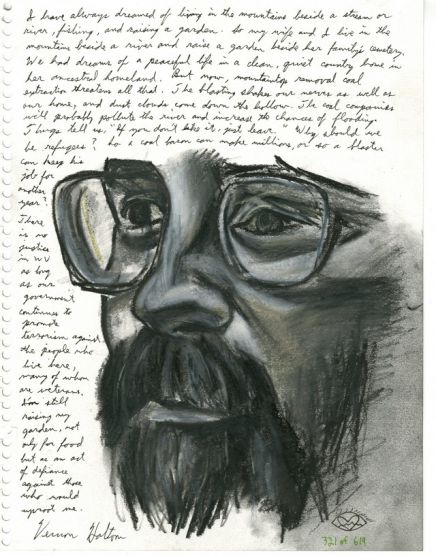
Vernon Haltomhazy-02-marsh-fork-elementary
Debbie Jarrellcoal_river_101-06-changes-in-lifestyle
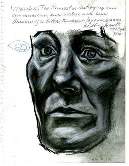
Debbie Jarrellhazy-04-hazy-and-shumates-today
Debbie Jarrellwind-01-introduction-to-coal-river-wind
Debbie Jarrellhazy-02-marsh-fork-elementary
Debbie Jarrellcoal_river_101-05-outmigration
Jen Oshacrm-03-undergound-mining
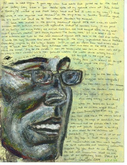
Jen Oshacoal_river_101-06-changes-in-lifestyle
Jen Oshahazy-04-hazy-and-shumates-today
Jen Oshacrm-05-the-brushy-fork-slurry-impoundment
Jen Oshaprenter-07-news
Jen Oshacrm-04-forest-resources-and-timbering
Jen Oshahazy-01-near-the-mouth-of-hazy
Jen Oshahazy-02-marsh-fork-elementary
Ed Wileyhazy-02-marsh-fork-elementary
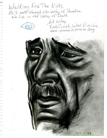
Ed Wileyhazy-04-hazy-and-shumates-today
Ed Wileycrm-02-community-land-use-in-coal-river-valley
Ed Wileycoal_river_101-06-changes-in-lifestyle